
Are you tired of the usual city outskirts and yearning for more breathtaking landscapes and challenging routes? China, with its rich outdoor resources, offers not only stunning visual feasts but also profound cultural and historical experiences. Here are 12 of the most beautiful hiking trails in China that will surely make you want to pack your bags and set off immediately. How many have you ticked off your list?
Kula Kangri | The Only Trail Comparable to EBC
- Duration: 4–7 days
- Distance: 55–85 kilometers
- Best Hiking Season: May–October
Kula Kangri, a mountain located in the Tibet Autonomous Region near the border with Bhutan, is a hidden gem. Despite being only 270 kilometers from Lhasa, it is relatively unknown and rarely visited.
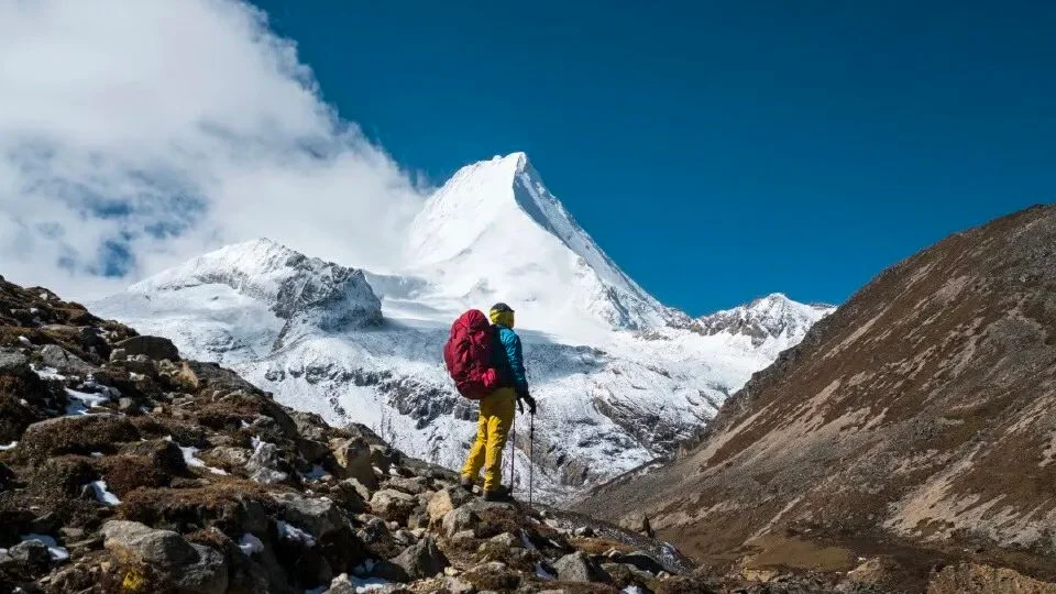
The mountain range, with its snow-capped peaks and glaciers, offers a grandeur comparable to the famous Everest Base Camp (EBC) in Nepal. The route encompasses the most classic and mysterious spots in southern Tibet, as well as the charming and gentle beauty of numerous alpine lakes like Zhegong Co, Baima Lin Co, and Jiejiu Co.
The Kula Kangri massif, stretching east to west, forms an immense icy barrier that blocks the warm and moist air currents from the Indian Ocean, resulting in starkly different landscapes on either side of the ridge. The north side is sunny and dry, with vast glaciers, spectacular ice towers, cliffs, and walls in the mountain valleys. In contrast, the south side is humid and rainy, dotted with beautiful alpine lakes that shimmer like precious gems against the backdrop of the majestic snow-capped mountains.
On the way to Kula Kangri, you will also get to enjoy the renowned Yamdrok Lake and Pumoyong Lake in southern Tibet, where you can lose yourself in the deep blue that seems closest to the sky.
Reference Route: Lhasa–Yamdrok Lake–No. 1 Lake Camp–Kula Peak South Slope Camp–Baima Lin Co–Zhegong Co–Over Kalha Pass–No. 4 Camp–Geduo Village–Yamdrok Lake–Lhasa
Tiger Leaping Gorge High Road | The Classic Leisure Hiking Trail in China
- Duration: 2 days
- Distance: 21 kilometers
- Best Hiking Season: April–June, September–October
The Tiger Leaping Gorge High Road, located at the foot of Habo Snow Mountain, is famous for its steep, unique, and beautiful scenery. It is also one of the “World’s Top Ten Classic Hiking Trails.” The beauty of the gorge is captivating, and its majestic presence is awe-inspiring.
The trail runs alongside the majestic Jade Dragon Snow Mountain, offering views of its thirteen peaks throughout the journey. The middle section of the gorge, with its dense reefs and steep cliffs, is a thrilling experience. This route, known as one of the wildest and most beautiful classic hiking trails in China, is a must-do for any adventure enthusiast.
Despite its reputation as a world-class hiking route, it is not as challenging as it might seem. The 21-kilometer-long gorge, with the roaring Jinsha River flowing through it, is accessible to hikers with some experience. As you walk along the high road, you will be rewarded with breathtaking views of the river and the surrounding mountains.
However, safety should always come first. The trail can be slippery during the rainy season, and there is a risk of falling rocks. The steep ladder down to the bottom of the Middle Tiger Leaping Gorge requires careful navigation. But once you reach the end, the sound of the rapids will linger in your memory.
Reference Route: Lijiang–Upper Tiger Leaping Gorge–Ladder–Middle Tiger Leaping Gorge–Halfway–Tea Horse Inn–28 Zigzags–Tiger Leaping Gorge Town
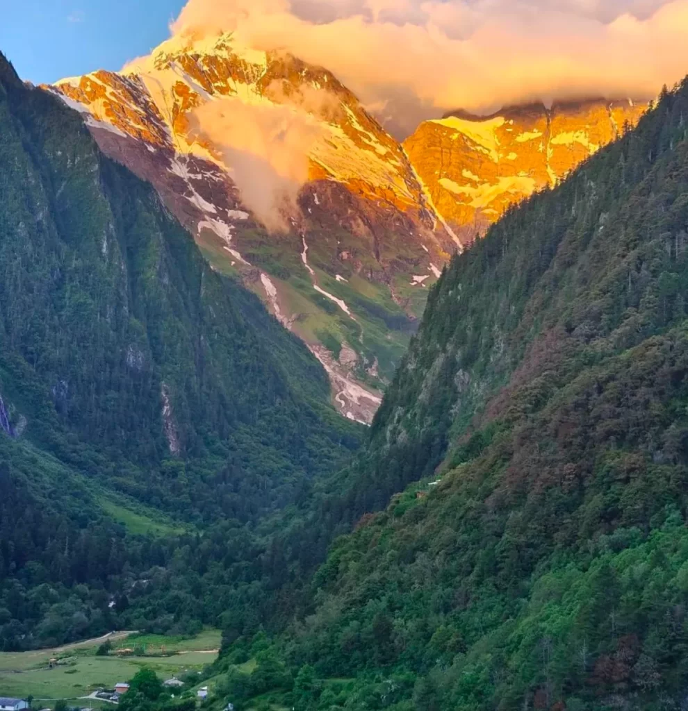
Motuo | The Top Hiking Trail in China
- Duration: 3–7 days
- Distance: 78 kilometers
- Best Hiking Season: September–October
Motuo, known as the “Lotus Secret Land” of Tibet, is the last county in China to be connected by a road and is considered the number one hiking trail in China.
The journey involves crossing the 4,200-meter-high Duoxiongla Snow Mountain and navigating through leech-infested areas, all while being on high alert for landslides and mudflows. This challenging three-day route is a classic that cannot be replicated.
With its dramatic altitude variations, from the 7,782-meter-high Namcha Barwa Peak to the 152-meter-high Baxika, Motuo boasts a distinct vertical distribution of ecosystems. Dense forests, rolling hills, alpine vegetation, and snow and ice layers can all be found here.
The road to Motuo has always been perilous, and the region is isolated for seven to eight months each year due to heavy snowfall. This remote and challenging destination, often referred to as the “Hellish Road to Heaven,” is a true test of endurance and determination.
Reference Route: Nyingchi Pomi Township–Songlin Port–Duoxiongla–Lage–Hanmi–Laohumouth–Beibeng–Motuo County
Kalajun | The Most Beautiful Photography Trail in the Tianshan Mountains
- Duration: 7–9 days
- Distance: 100 kilometers
- Best Hiking Season: May–August
If you are looking for the ultimate grassland experience, Kalajun in Xinjiang’s Ili region is the place to be. This trail, spanning 100 kilometers across the Tianshan Mountains, offers a diverse range of landscapes, including grasslands, dense forests, snow-capped mountains, glaciers, and lakes. It is no wonder that it is hailed as the “most beautiful photography trail in the Tianshan Mountains.”
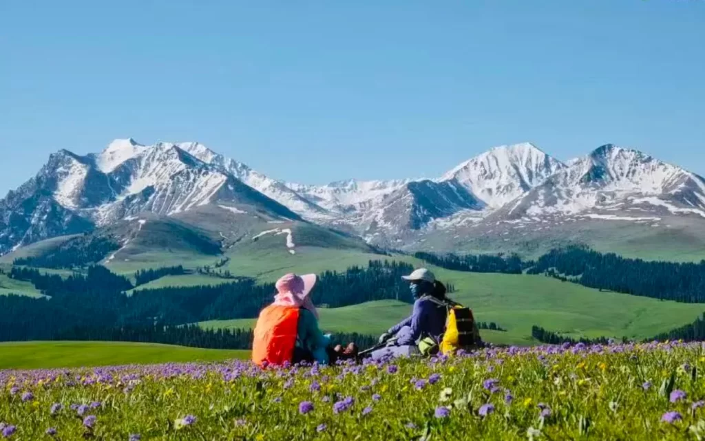
As one of the most popular grassland routes in China, Kalajun features the Tianshan coniferous forests and mountain meadows, as well as a unique and well-preserved ecosystem. It is also one of the most biodiverse regions in Xinjiang.
The trail takes you through a three-dimensional grassland landscape that is anything but flat and monotonous. The undulating terrain and varied vegetation make for a visually stunning experience. In May and June, the grasslands are covered in a sea of colorful flowers, creating a breathtaking and vibrant scene.
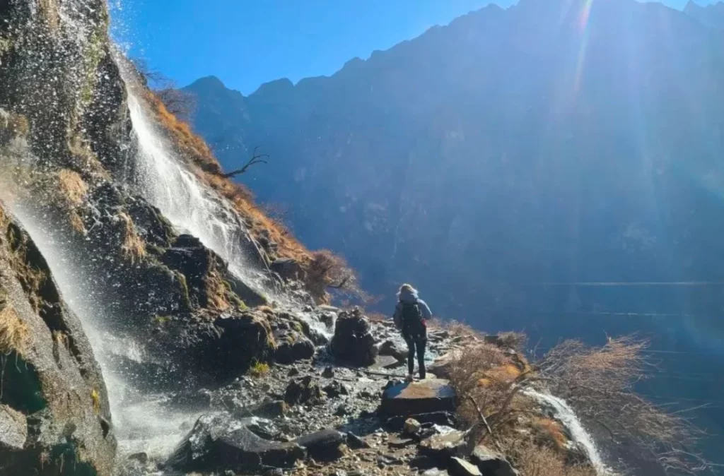
Yubeng | Heaven to the Left, Yubeng to the Right
- Duration: 6 days
- Distance: 110 kilometers
- Best Hiking Season: September–November
For many hikers, Yubeng, nestled deep in the Meili Snow Mountain range, is their version of paradise. This hidden gem, often compared to the “Peach Blossom Spring” described by Tao Yuanming, offers a series of breathtaking sights such as the Sacred Lake, Sacred Waterfall, Stone Inscriptions, and the Five Trees Growing Together.
The name Yubeng is said to originate from the local climate. Located at the foot of a snow mountain, the area is constantly showered by melting snow, which resembles raindrops falling from the sky.
The dense primeval forest is just the beginning of what Yubeng has to offer. Once you cross the 3,700-meter-high Nanzheng Pass, the landscape unfolds before you. From the lush primeval forest at an altitude of around 3,000 meters to the snow-capped peaks above 6,000 meters, the distinct layers of vegetation represent a natural vertical zonation that spans all four seasons.
Yubeng’s allure lies not only in its legendary status but also in the unique experiences it offers. Glimpsing the true face of Meili Snow Mountain and witnessing the awe-inspiring sight of Tibetan Buddhists circumambulating the mountain are just the tip of the iceberg. Only by hiking through Yubeng can you unlock the secrets of this heavenly destination.
Reference Route: Lijiang–Feilei Temple–Lancang River Grand Canyon–Xidang Village–Yubeng Village–Base Camp–Ice Lake–Shangyubeng–Xiaoyubeng Village–Shenpu–Xiaoyubeng Village–Xidang Hot Springs/Niyong Grand Canyon–Feilei Temple–Baima Snow Mountain Pass–Benzilan–Shangri-La
Changchuanbi | The Eastern Alps of China
- Duration: 3–4 days
- Distance: 36 kilometers
- Best Hiking Season: September–October
In the outdoor paradise of western Sichuan, Changchuanbi is known as the “Eastern Alps” and is one of China’s top ten classic hiking trails
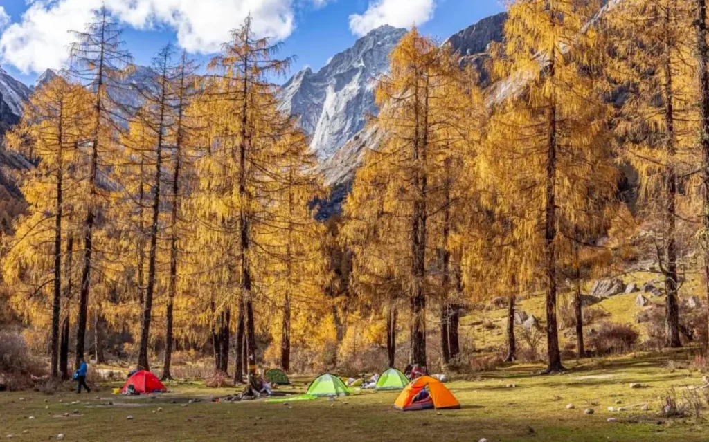
The route offers stunning views of the Changping Valley and Shuangqiao Valley, as well as a close-up look at the four peaks of Mount Siguniang and the surrounding snow-capped mountains. The Changping Valley, with its 70% forest cover, is home to a diverse range of plant species and is well-preserved. In autumn, the valley is carpeted in golden leaves, creating a breathtaking scene.
Only a portion of the valley is accessible by vehicle, while the rest can only be reached on foot or by horseback. Passing through the Changping Valley, you can reach the foot of Mount Siguniang and then cross over to Libeng Valley in Li County.
The majestic Yomei Peak will watch over hikers as they cross the pass and will only disappear from view once they enter Libeng Valley.
As an ideal starting point for transitioning from the plains to the plateau, Changchuanbi features well-developed facilities and a wild charm. The relatively low altitude and rich vegetation ensure adequate oxygen levels, reducing the risk of altitude sickness and making it accessible to most people. It is one of the best plateau hiking routes for beginners.
Reference Route: Chengdu–Siguniang Mountain Town–Lama Temple–Muluozi Camp–Kazigouwei Camp–Pass–Santrees Camp–Libeng Valley–Chengdu
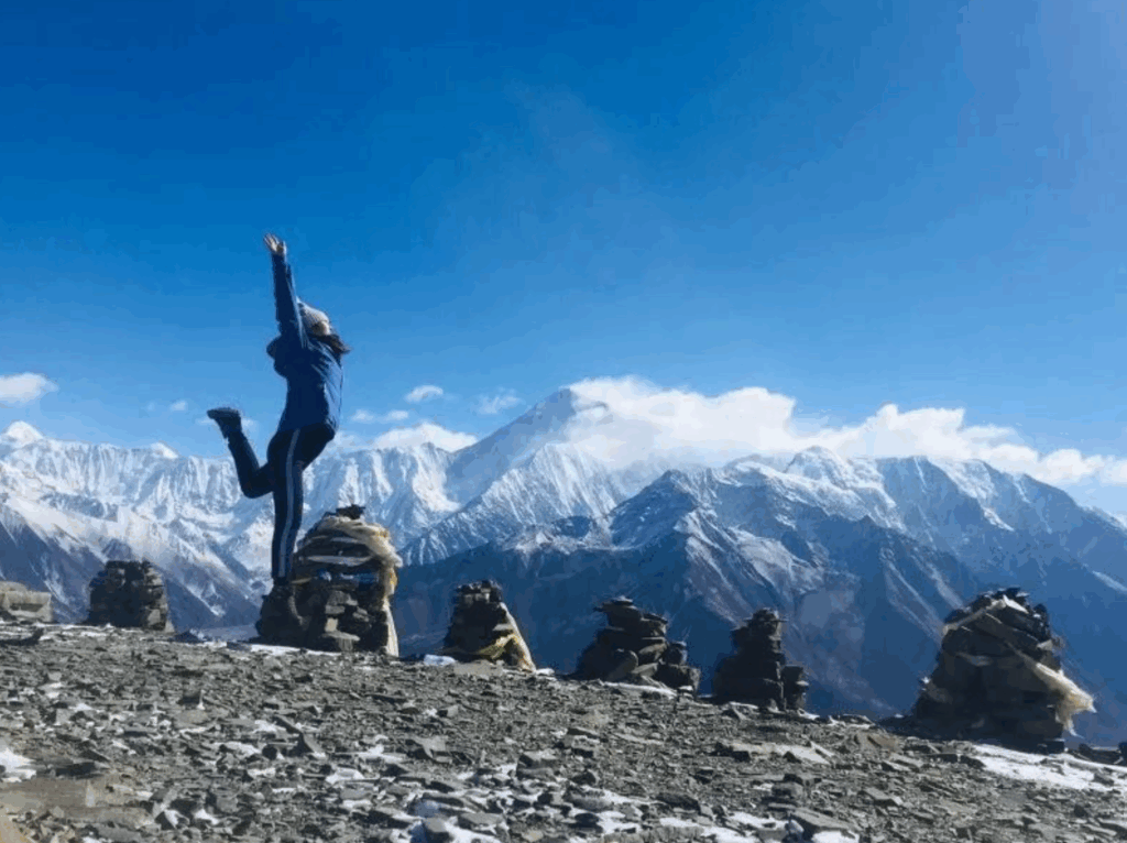
Mount Kailash | The King of Mountains and the Center of Faith
- Duration: 2–3 days
- Distance: 52 kilometers
- Best Pilgrimage Season: April–October
For many, Mount Kailash in Ngari is the ultimate destination for spiritual pilgrimage. This peak of the Gangdise Mountain Range, although only 6,656 meters high, is revered as the king of sacred mountains. It is one of the four sacred mountains in Tibetan Buddhism and is considered the center of the world by four major religions.
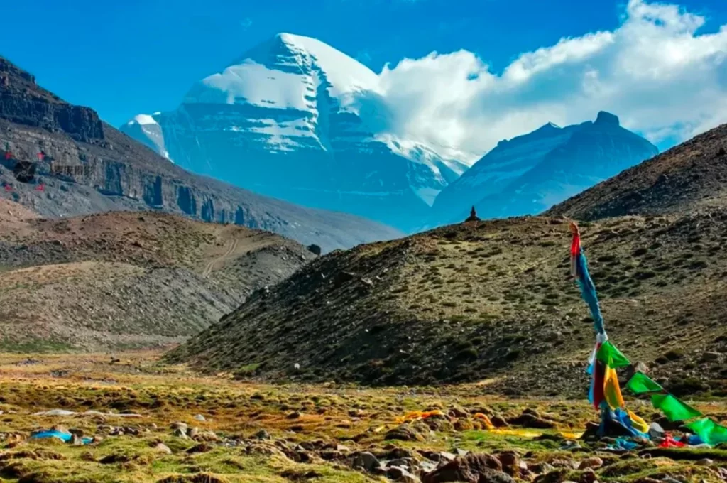
Every year, a large number of people come to Mount Kailash to make the kora (a ritual circumambulation). It is believed that completing one circuit around the mountain can cleanse one’s sins from a lifetime; ten circuits can free one from suffering in the afterlife for 500 reincarnations; and 108 circuits can lead to enlightenment in this life.
This route is also one of the most famous hiking trails in the world. From May to October, when the mountain is not blocked by heavy snow, many domestic and international hikers and tourists come to experience its grandeur.
Mount Kailash, part of the Gangdise Mountain Range that stretches across the Tibetan Plateau, is remote and difficult to reach. The high altitude of the kora route pushes the limits of human endurance. Even with strong faith, not everyone can successfully complete the journey.
However, the reward of completing this challenging high-altitude adventure, with its stunning plateau scenery and spiritual fulfillment, makes it all worthwhile.
Reference Route (Outer Kora): Lhasa–Taklakot–Chugu Monastery–Zherap Monastery–Dzongnar Pass–Sonam Choephel Monastery–Baga Grassland–Taklakot–Lhasa
Shangri-La Trail | The Last Shangri-La on Earth
- Duration: 5–7 days
- Distance: 65 kilometers
- Best Hiking Season: October–November
Every avid hiker with a passion for the plateau has one name on their must-visit list: the Shangri-La Trail.
“Throughout the entire world, what place still has such scenery waiting for photographers and explorers?” In the 1920s, American explorer Joseph Rock described Yading in this way. Both in terms of cultural and natural beauty, the Shangri-La Trail is one of the top trails in China.
People have referred to the “Shangri-La” described in novels as a “paradise on earth,” and a global search for this utopia began. The route that Joseph Rock took from Muli to Gongga Ridge during his exploration is what later became known as the Shangri-La Trail.
Hiking along the Shangri-La Trail, through the beautiful high-altitude canyons of the Hengduan Mountains, you can feel the breath of ancient times and the purity of the hidden secrets. After enduring the hardships and finally reaching the longed-for destination, you will understand the irresistible charm for outdoor enthusiasts.
This is one of the few remaining pristine areas on Earth, a place where human presence is limited.
Those who wish to witness its beauty must follow the ancient Tea Horse Road, hike deep into nature, and circumambulate the three sacred mountains to catch a glimpse of the magnificent scenery that is usually out of reach for ordinary people.
Reference Route: Chengdu–Xichang–Muli–Galuo Village–Zangbie Pasture–Xinguo Pasture–Shehu Camp–Yading–Xindu Bridge–Chengdu
South Taihang | God’s Favorite Northern Backyard
- Duration: 3 days
- Distance: 90 kilometers
- Best Hiking Season: April–October
The South Taihang Mountains, serving as the boundary between the North China Plain and the Loess Plateau, offer unique geological wonders. They combine the grandeur of the north with the delicacy of the south.
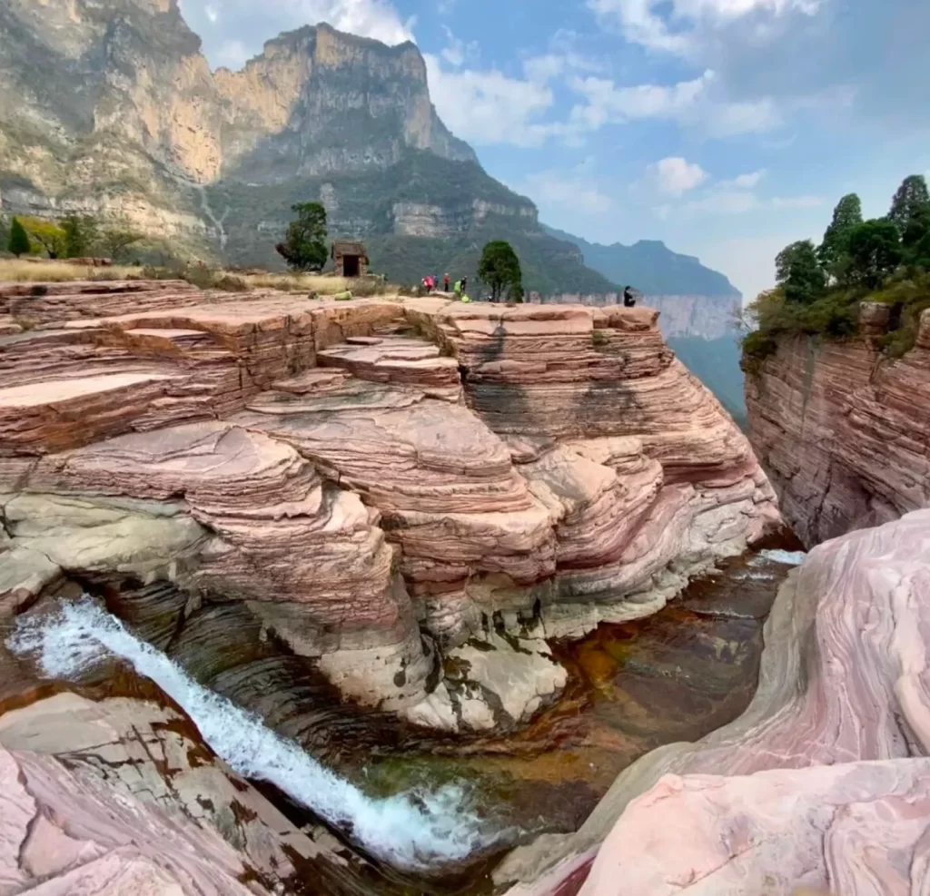
Located mainly on the northwest side of Xinxiang City in Henan Province, at the border between Henan and Shanxi, the South Taihang Mountains are like a favorite of God, blessed with abundant water. The sunrise here rivals that of Mount Tai, and the sea of clouds is comparable to Huangshan. The hanging wall roads are a marvel in the history of road construction. These are some of the most famous natural landscapes of the Taihang Mountains, all gathered in the South Taihang area.
The majestic Taihang Mountains, with their steep cliffs and numerous canyons, offer a combination of grandeur and delicacy, creating a breathtakingly beautiful landscape. The hanging wall roads, built on the sheer cliffs, look like magnificent landscape paintings from a distance. Looking out from the side windows of the tunnel, it feels like you are in an art gallery, admiring a series of landscape paintings.
In March every year, the forsythia, peach blossoms, apricot flowers, and pear blossoms in the Taihang Mountains bloom in competition. The canyons are covered with yellow, red, and white flowers, creating a spectacular scene.
Reference Route: Xigou–Guanshan–Xilian–Xiqiagou–Wangmangling–Guoliang–Phoenix Mountain–Qi Wangzhai
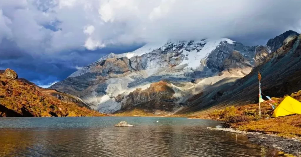
Minya Konka Grand Loop | A Pilgrimage to the King of Sichuan Mountains
- Duration: 7 days
- Distance: 100 kilometers
- Best Hiking Season: June–November (weather is unstable in July–August)
“Yearly watch, lifelong Minya Konka.” Among China’s most beautiful mountains, Minya Konka is second only to Namcha Barwa. Known as the “King of Sichuan Mountains,” it features a “white ice mountain” with numerous peaks over 6,000 meters, deep snow and ice, and formidable challenges. It is a pilgrimage destination for every hiker.
The summit of Minya Konka is perpetually covered in snow, surrounded by 28 peaks over 6,000 meters. The area boasts a variety of landscapes, including glaciers, alpine meadows, flower seas, and river valleys. In October and November, the autumn colors of the mountains are stunning, with snow-capped peaks and colorful forests in full view.
There are many hiking trails at the foot of the mountain, connecting various snow peaks, glaciers, river valleys, and lakes. Every year, numerous mountain enthusiasts and photography lovers flock to the area.
The Minya Konka Grand Loop, which is about 100 kilometers long, is an excellent choice for many hikers to experience high-altitude trails. The well-developed route allows hikers to see most of the beautiful scenery in the Minya Konka area.
At an average altitude of around 4,000 meters, with snow mountains on one side and the sun on the other, the continuous surprises and the feeling of being in an outdoor paradise in the east of Minya Konka are unforgettable.
Reference Route: Chengdu–Laozhanglin–Gexi Grassland–Shangriuqi–Moqi Valley–Minya Konka Monastery–Zimei Pass–Caoko–Chengdu
Wusun Ancient Road | The Most Beautiful Trail in Xinjiang
- Duration: 6–8 days
- Distance: 120 kilometers
- Hiking Season: June–September (July–August is the peak period)
- Destination: Qionghushutai, Tianshan, Xinjiang
The Wusun Ancient Road, a 130-kilometer trail spanning the northern and southern Tianshan Mountains, offers a diverse range of landscapes, including grasslands, dense forests, snow-capped mountains, glaciers, and lakes. The scenery changes with every step, making it a truly breathtaking experience.
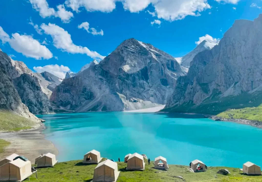
This is one of the top hiking trails in Xinjiang. The serene and deep blue Tianchi Lake, surrounded by snow-capped mountains and reflecting the blue sky, creates a charming and unforgettable scene.
However, this ancient road is not only beautiful but also challenging. The highest point along the route, Akbulak Pass, reaches an altitude of 3,900 meters. The deep and rapid rivers along the way require the use of zip lines to cross (horse riding is also available for those who prefer it). The combination of beauty and danger makes this experience unforgettable.
Along the trail, you will also see many ancient fortresses, beacon towers, and passes, transporting you back to a bygone era.
Reference Route: Qionghushutai Pastoral Village–2,850-meter-high wooden house–Bazhada坂–Keksu Riverbank wooden house–Keksu River zip line crossing–Akbulak Valley/Forest Station–Tianchi Lake (Akku Lake)–Akbulak Pass–Boaozikilik Valley–Heiyingshan Pass/Meadow (reverse route is also possible)
Zha Na | The Stone City Hidden in the Mountains
- Duration: 7 days
- Distance: 50–55 kilometers
- Hiking Season: June–October (lush green in summer, colorful forests in autumn)
Among the many hiking routes in western China, Zha Na stands out as a local and lesser-known destination. The Zha Na hiking routes are diverse, offering both short and long options. You can follow in the footsteps of Joseph Rock or simply enjoy a leisurely walk through the valleys.
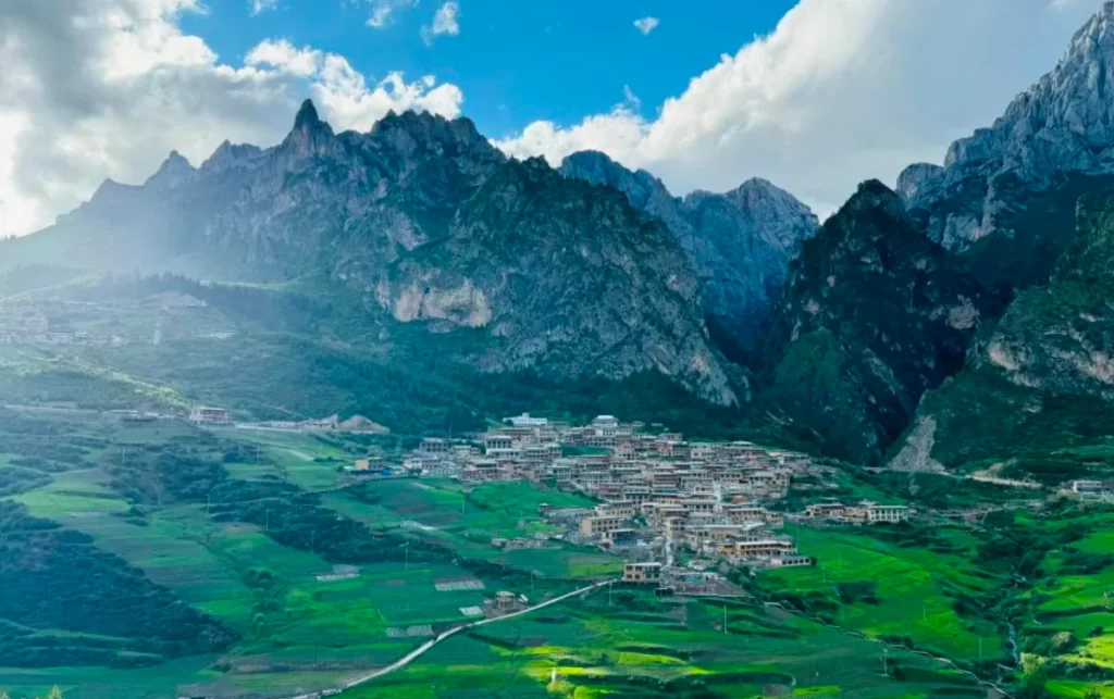
Located in Diebu County, Gannan Tibetan Autonomous Prefecture, Gansu Province, at the junction of the Tibetan Plateau, Loess Plateau, and Sichuan Basin, Zha Na has an altitude of 3,000–3,300 meters, with the highest peak in the surrounding area reaching 4,500 meters.
The area boasts stunning scenery, including canyons, strange rocks, forests, and alpine meadows. The majestic and spectacular stone peaks surrounding the region create a beautiful and picturesque landscape. The hiking difficulty is moderate, making it suitable for first-time high-altitude hikers.
The grasslands, caves, and alpine lakes here are as beautiful as those in Sichuan’s Jiuzhaigou. Walking through the pristine rural scenery and experiencing the unique cultural atmosphere is truly a joyful experience.
Please note that these 12 most beautiful hiking trails in China are truly spectacular, but those without high-altitude hiking experience should not rush into them. It is advisable to gain more experience and build up your physical strength at lower altitudes before attempting these routes.
Which of these 12 most beautiful hiking trails do you think are missing? Or which ones have you been to? Feel free to leave a comment and let us know.